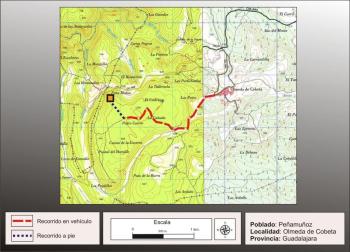

Getting there
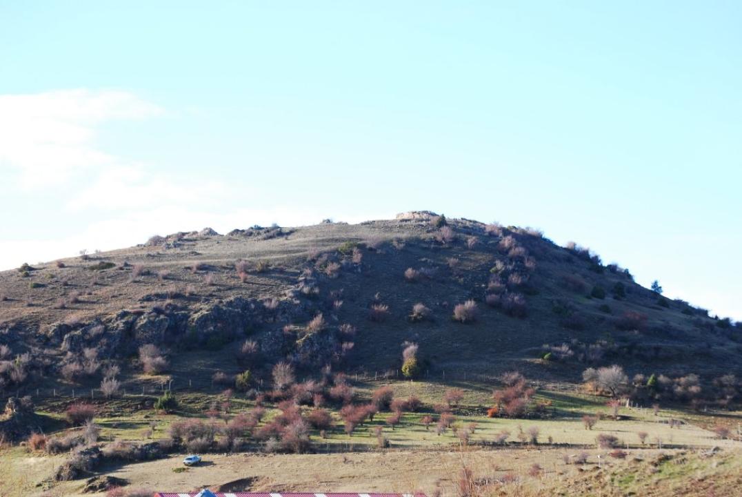
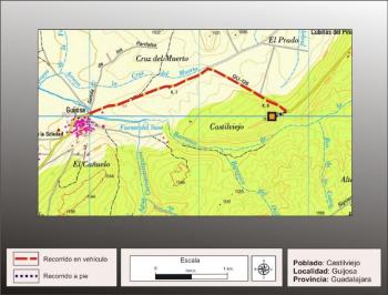
From the Czech people take the GU-982 provincial road towards the south, after covering a little less than 2 km you reach a rather prominent hill located to the right and on top of a warehouse, moving a few meters there is a small parking and a poster explaining the peculiarities of the geological formations of the area, as part of the Alto Tajo Natural Park. Behind the poster is glimpsed the steep path that leads to the top of the hill, Pedro Maza, where the fort.
Situation and location
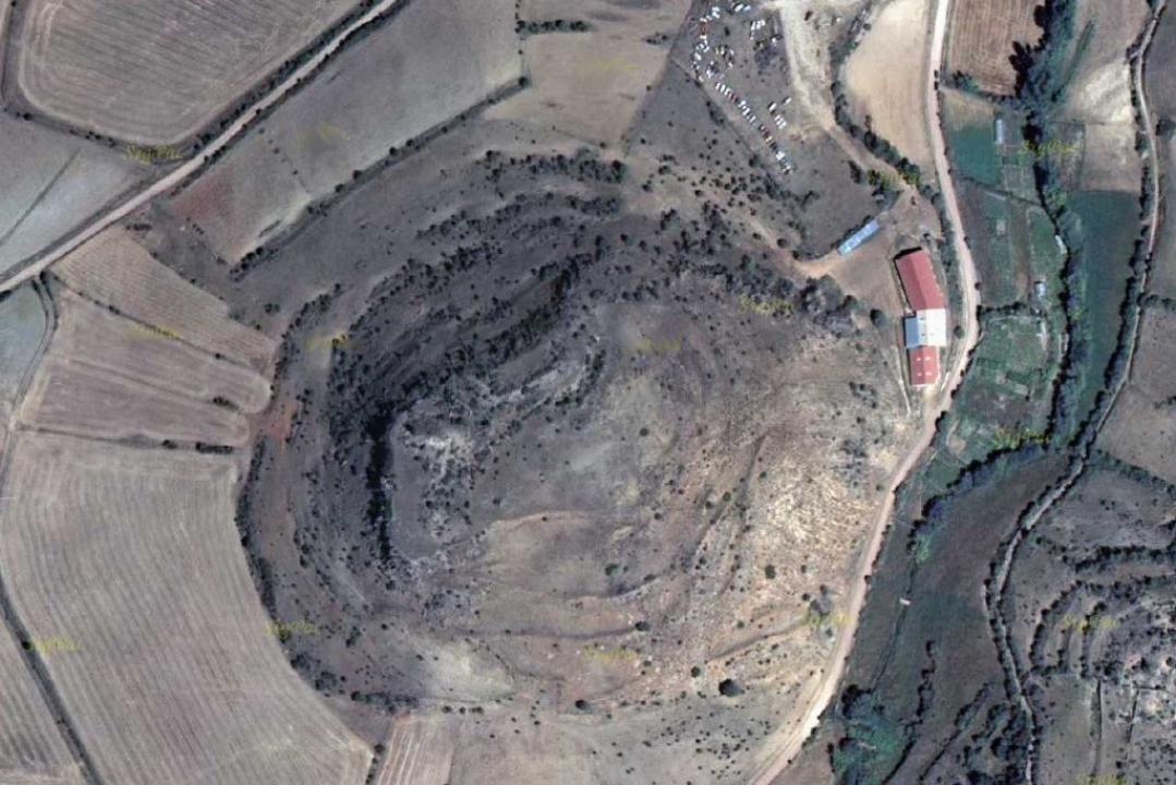
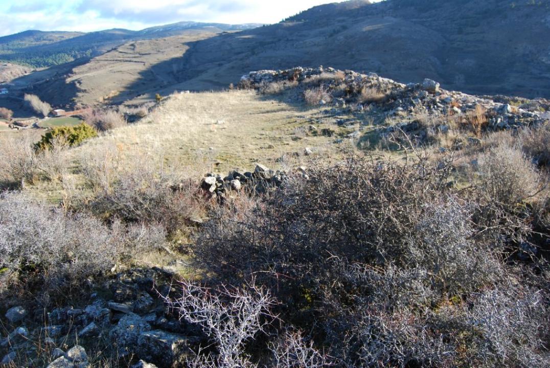
Located in the Alto Tajo, in the contact zone between the Sierra de Albarracín and the Serrania de Cuenca. It occupies the top of a high conical hill above the valley of Arroyo de la Pedrera, 1.474m above the sea level.
Research
Is cited and described by P. Madoz, in his Dictionary statistical-geographical-historical (1848), as "Castil-Greeks, placed at the top of a round hill and enough lift, difficult and steep ascent from N and O, guarded by enormous S and high cliffs and accessible only by E., the circumference of the top of the hill is a rectangle of 170 feet long by 70 wide bypassed a large pit, in the said center is strong, which is still preserved pieces of stone wall, very solid with three yards of elevation and as many thick, tickets are two underground, one has two outlets forming an obtuse angle, and the other goes to the interior, being the end of this one crushed stone pit alive, and traces of a fortress for his defense. "
This site was studied and published by Jesus A. Arenas (1987-88/1999), with the name of protohistoric village of El Pinar. He is currently in the process of excavation, consolidation and rehabilitation of its defensive structures, led by Juan Pablo Martínez and José Ignacio de la Torre, in the context of systematic excavations each summer starts the Ministry of Culture the Junta de Comunidades de Castilla-La Mancha in collaboration with INEM.
CASTRO TO VISIT
Settlement characteristics
Is rectangular and is walled on three sides, leaving the defense of northwestern strong at the expense of natural cut that protects it. Its major axis is about 44m by 13m width just the child, reaching an area of approximately 680m2.
Defensive System
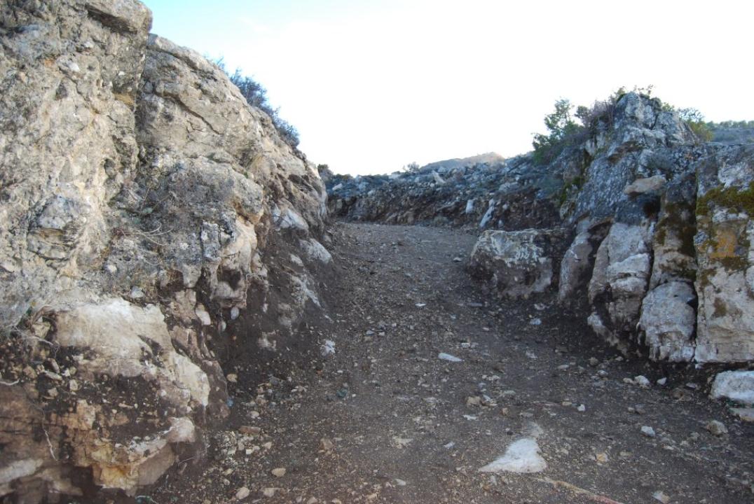
-The Pit:
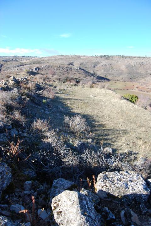
The moat surrounding the fort on the north side, south and east as the west is the natural cut. Is dug into the rocky mantle, drawing in part on the natural break. Its width of 4.46 m and height of about 4m, being detached from the wall between 9 to 10m.
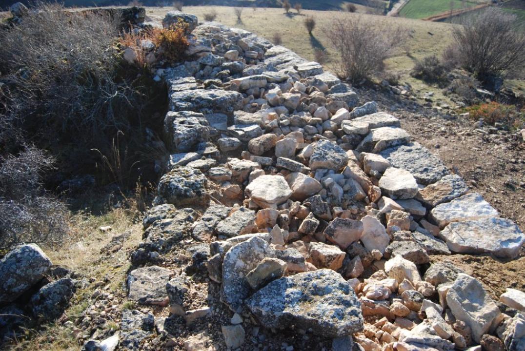
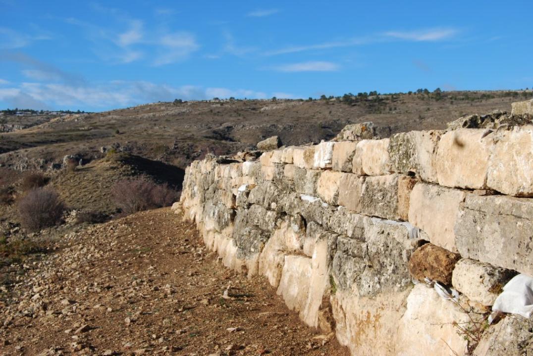
-The wall:
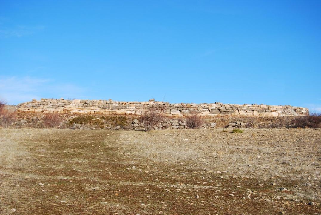
The wall, which has a circumference of about 82m and about 2.60 m wide, delimited by three sides of the fort, and built with large blocks of limestone, not well squared, sometimes reaching dimensions of 1.65 m long by 0.40 m wide, and some are not square base, reaching sizes of 1.35 by 1.27 m.
The stretch of the wall remained about three courses and has been renovated or rebuilt about 3 rows superimposing new, separated by a mesh lower geotextile for differentiation and now stands about 2m tall. The north side of the wall is about 20 m long, the east about 46 m long and about 18m south side.
-The tower:
In the south, separated by the moat of the fort, the difference between a square structure surrounded by a large accumulation of landslide of rocks and debris, which could correspond to the fort referred Madoz, which could also be a Muslim fortress later ?
Interior space
The interior of the fort is still under excavation, but its small size, approximately 680m2, cobijaría about 11 houses or rectangular spaces (about 40m2) supported by one of its narrow sides of the wall, leaving a central space (200m2) for communal activities open to the natural.te cut about 46 m long and about 18m south side.
La necrópolis
Está situado al pie del castro, a unos 300m, junto a la carretera (GU-982) que remonta al ato Tajo. La necrópolis, excavada en los pasados años, está en proceso de estudio para su publicación por los Directores del proyecto J. P. Martínez y J. I. de la Torre.
Se trata de una necrópolis de incineración celtibérica, relacionada con el castro próximo. Las tumbas estaban alineadas de Noreste a Suroeste y encerraban urnas de cerámica con los restos de los cuerpos incinerados, acompañados de los ajuares funerarios, desde collares y broches, hasta cuencos de cerámica, donde hacían sus ofrendas a los muertos.
En esta necrópolis, que Se fecha en el siglo II a. C., fueron enterrados los habitantes del castro próximo y su estudio aportará importante información para el conocimiento de las costumbres, creencias y ritos funerarios del mundo celtibérico.
Bibliography
- Arenas, J.A. (1987-88): The protohistoric village of El Pinar (Chera, Guadalajara). Kalathos, 7-8.
- Arenas, J.A. (1999): The Iron Age in the central Iberian System, Spain. BAR International Series 780, Oxford.
- Naranjo Martínez, J.P.; Torre, J.I. the (2009): The Greeks Castil-Castro, Checa (Guadalajara), in press.
Contacts and schedule
- It is unmarked and access is free