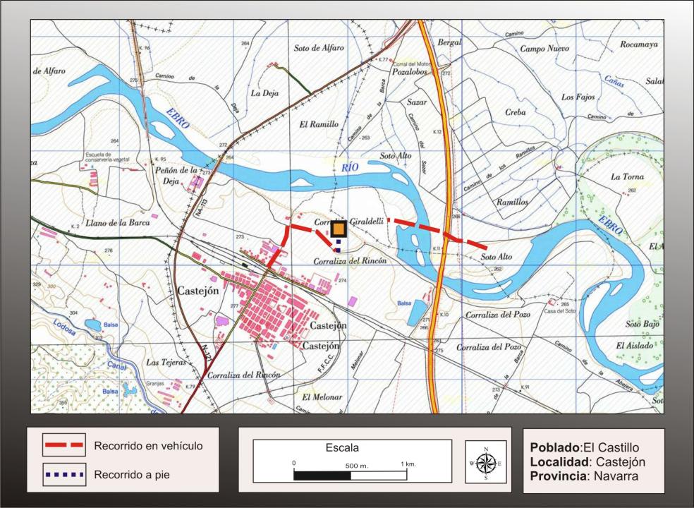
Getting there
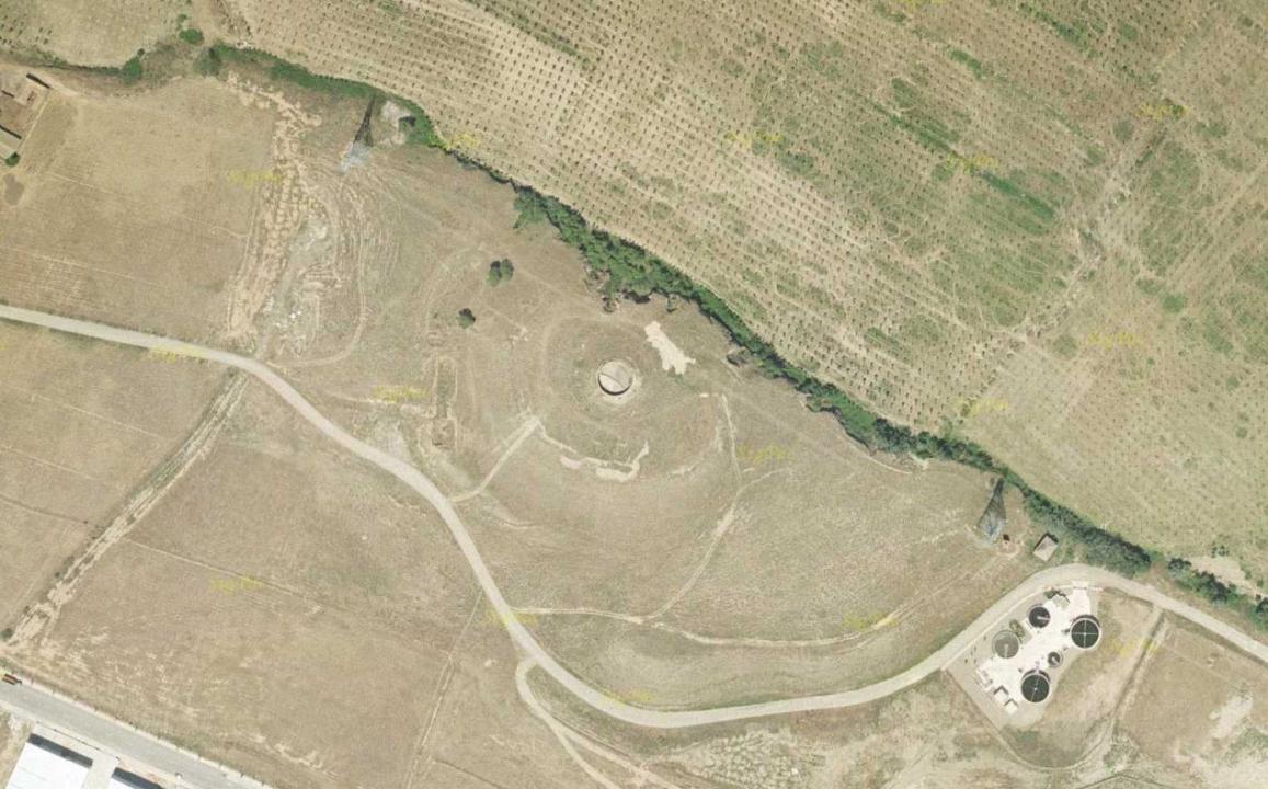
It is located in the Industrial District of Castejon, built between the village and the river Ebro El Castillo is located on the river in the northeast of the polygon.
Situation and location
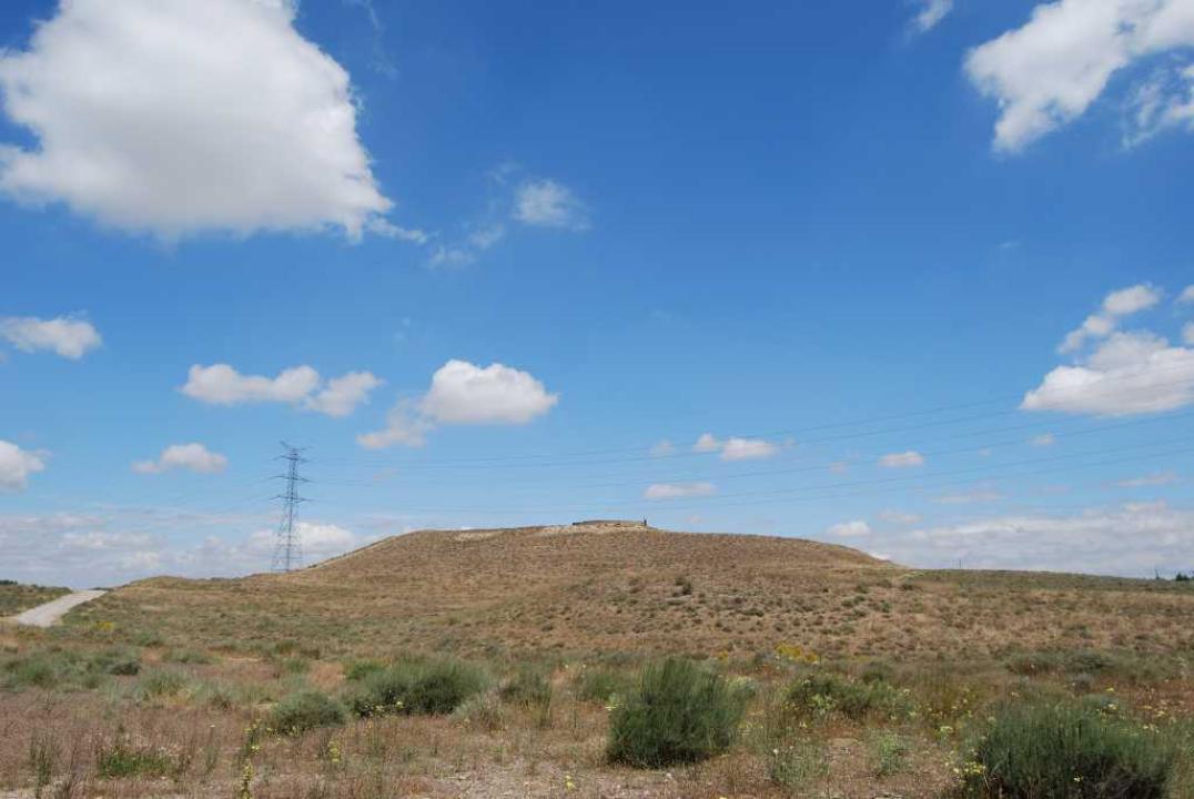
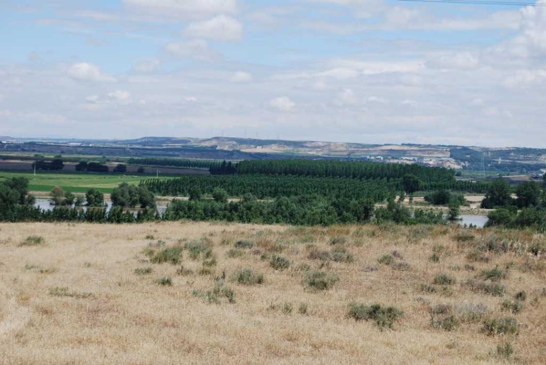
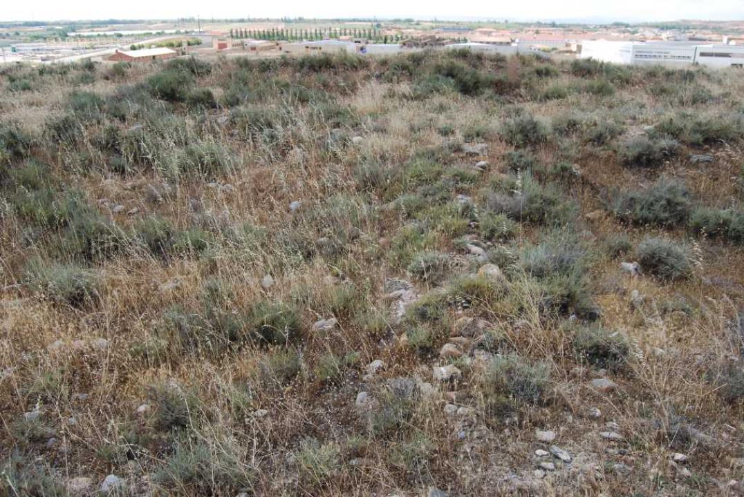
This settlement is situated downstream from the mouth of Alhama, in the right bank. It occupies a hill, hanging over the river, situated at an altitude of about 292m above sea level (about 40m above the riverbed).
Research
The Cerro del Castillo was the subject of different excavation campaigns in the 40 and 60 of the last century, under the leadership of Blas and Jorge Navascues Taracena.
Settlement characteristics
It was estimated that a minimum area of 2.7 ha, as a party by its northeast, has been destroyed by erosion of the river Ebro Celtiberian This town could prioritize the settlement of this area, the importance of being the starting point of one of the roads, that from the Ebro, following the course of Alhama, with support Contrebia Leukade (Aguilar del Rio Alhama), communicates with the plateau and the town of Numancia.
The defensive system
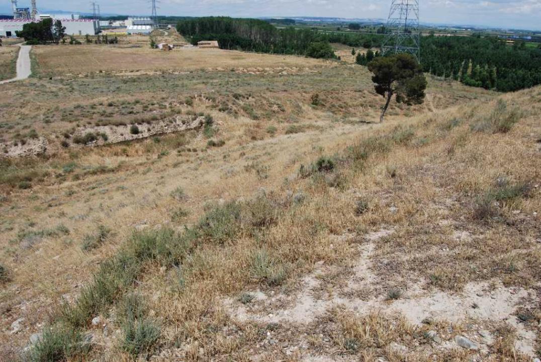
The difference between a double-walled fence, a wall around the acropolis, at the top of the hill, and a second wall to protect the village, with a moat in front, extending down the slope south-west, joining the wall superior. The part of the wall of both rooms, overlooking the river, has disappeared due to erosion of the Ebro
Socio-political and chronology
This town could have endured Celtiberian to s. III a. C. and perhaps played a central role in the ranking of settlement in the area, in an area where one track starts communication with the Ebro Valley Plateau, as is the Alhama river valley, which from the Ebro valley, through Contrebia Leukade, communicated with the high Duero Meseta, with reference to the town of Numancia.
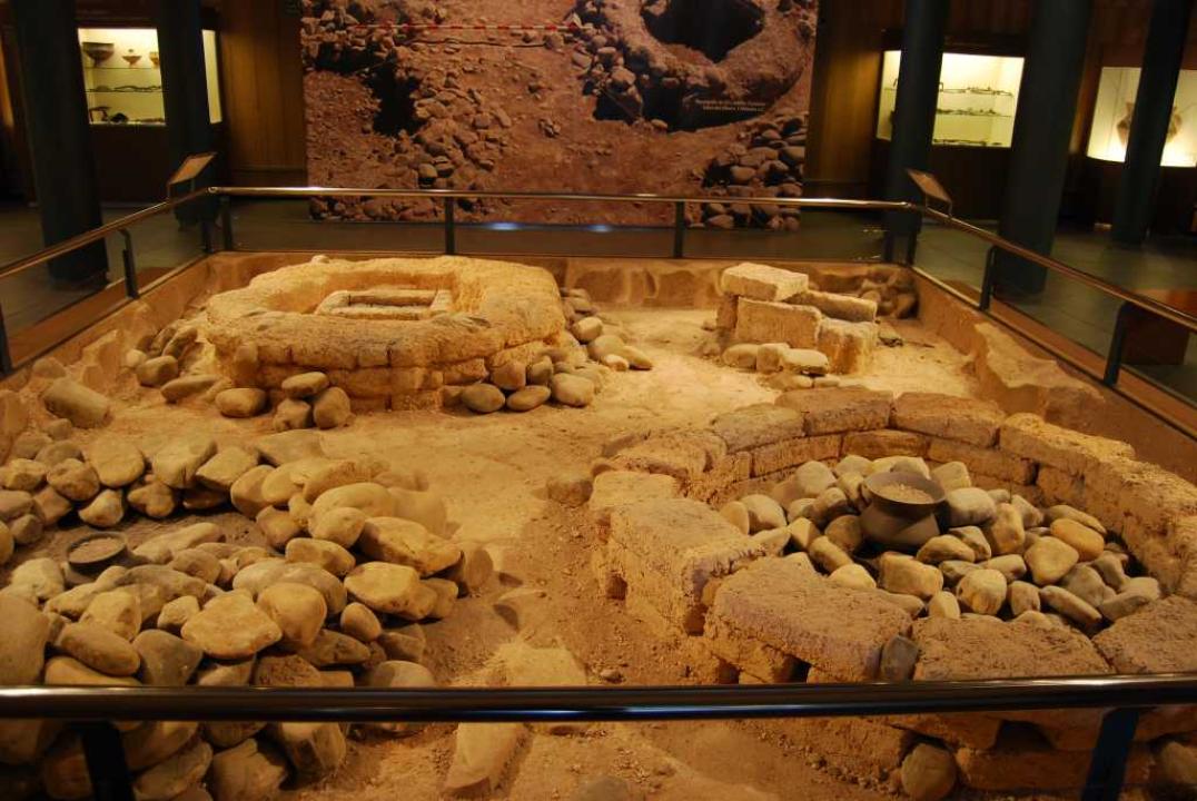
The necropolis (not visited)
Año1.999 In connection with the construction of a thermal power plant, the company hired the company Iberdrola archaeological SL FRAME conducting archaeological impact work on the land affected, resulting in the discovery of the necropolis associated with the town celtiberica, excavated in the following years, 2,000 and 2,002.
The variety of burial mounds and the uniqueness of their furnishings come to elaborate on the funeral ritual, the ethnic affiliation of this territory and its relations with other areas, through such a significant one-way communication between the Mediterranean and within peninsular as the Ebro
- Location and Location
The necropolis is located on a slight hill, about 450m to the southwest of the town Celtiberian.
- The funerary structures
Using the mound of stones (boulders) or adobe (rings and cysts). In some cases these mounds that protect the burial chamber (ceramic urns, metal or adobe cists) take the form of one or two outer rings, sometimes trails marked on surface by kneeling next to the outer ring.
- The outfits:
Objects found in graves show a great mastery of metal work in brass and iron, which is reflected in the ornaments, mainly made of bronze and tools and weapons made of iron.
The presence of weapons (spear, soliferrea, swords) and horse bites, reflecting the importance of the horse and the warrior in this social context. These social differences are enhanced by the presence of objects and import of materials from both the mainland (polls wing and Iberian falcata) and provenance of exotic Eastern Mediterranean (Egyptian scarabs), which come through colonizing peoples (Phoenicians).
- Ranking:
The differences in type and shape of the tombs, the existence of small tombs, associated with simple furnishings and deposits, in contrast to other large and complex architecture associated with rich and complex outfits, are interpreted as reflecting a hierarchy or distinction social within the group, also reflected in the association of weapons (spear, soliferrea, swords, an Iberian falcata) and bites of horse, see how the horse and the warrior was a sign of distinction of status and social dominance.
- Timeline:
Although still a serious study of this cemetery and unknown test results of C-14, the study of materials provides a chronology of the V-IV century BC, which could perhaps get to the BC, as seems to point the village.
Contacts and schedule
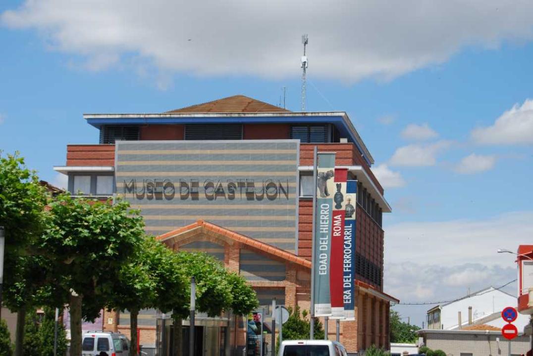
It is not signposted and access is free, but the grave goods found in the necropolis can be seen in the Museo Municipal de Castejon.