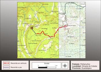
Getting there
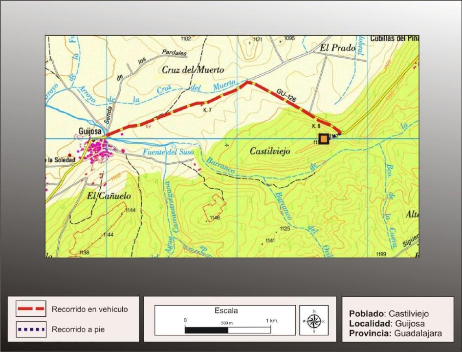
From Siguenza, flowing to the northeast, take the narrow road leading tovillage of Guijosa (you can seethe castle restored ) and passedthis village , about 1kmafter a sharp bend to the right continues to the next curve to the left, located at the foot of the fort (there is a slight widening in order to leave the car). Here we take the narrow path that climbs the steep slope east, to walk to the top.
Also accessible from the A-2, Alcolea del Pinar entering and following the road to Siguenza, to turn right along the narrow road leading to Cubillas del Pinar, just past the village, to reach the first corner, there is little space left to park the car and the path that climbs the hill on its eastern side, you enter the fort.
Situation and location
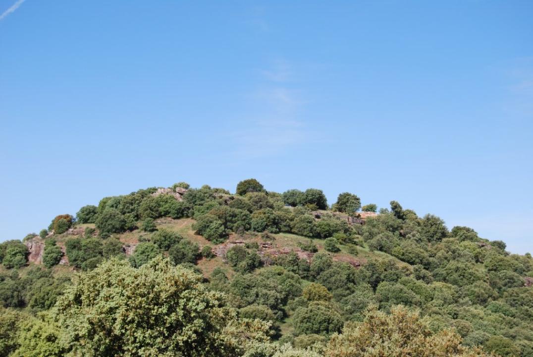
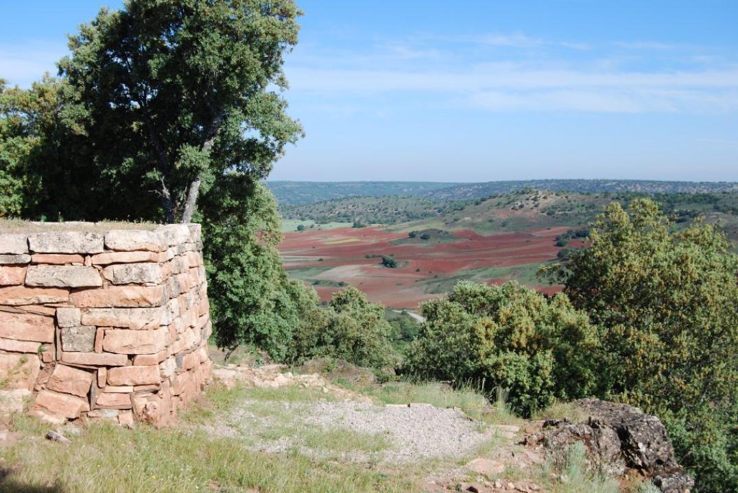
This high mountain is located in the province of Guadalajara, in the town of Siguenza, including Guijosa and Cubillas terms of the Rocks, as the demarcation between the two territories across its top.
This elevation, limestone base, has a maximum height of 1.1150m from the west, where it dominates the agricultural land of the river Henares, complemented with the rich pastures of nearby hills, which reach heights of over 1,200 meters.
Research
There is evidence from this site since 1929y quoted in 1953, the notes accompanying sheet No. 451, the Geological Survey of España.Los first excavations did not begin until 1977 and were carried out by M. Bethlehem, R. M. Balbin and Fernandez-Miranda, within the programming of the Museum of Guadalajara and suvencionados by the Directorate General of Artistic and Cultural Heritage, Archaeology Section of the Institution of Culture "Marqués de Santillana ", the Diputación Provincial de Guadalajara.
The recent cleaning and rehabilitation of defensive structures in this town are included in the systematic excavations each summer starts the Ministry of Culture of the Junta de Comunidades de Castilla-La Mancha in collaboration with INEM, This site managed by Ernesto Garcia-Soto Mateos.
CASTRO TO VISIT
Settlement characteristics:
The most visible archaeological remains, found in this hill celtibérica under the occupation, which was equipped with a complex defensive system.
Phases of occupation:
- The excavation works have been distinguished in this hill three different times of occupation, with no chronological continuity between them:
- The first corresponds to the end of the Bronze Age (XII-X centuries BC)
- The second moment belongs to a village celtibérica period (third century BC), which accounts for the defense system more visible.
- The latest occupation must have belonged to an Islamic fortress watchtower (X-XI century AD).
The interior space:
The interior of the fort is triangular in shape and is very devastated, showing in the old tasting some remains of houses square or rectangular structure, supported directly on the rock base. It is possible that in the area of the wall, the houses should build on it by its back wall.
The longest side of town is the west side, enclosed by the wall, which has a length of 90m long, while the east-west axis is about 60m, representing an area of between 3,000 and 4.000m2.
The defensive system:
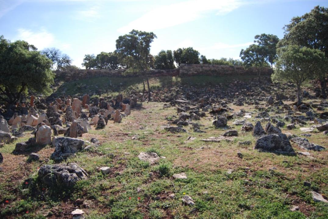
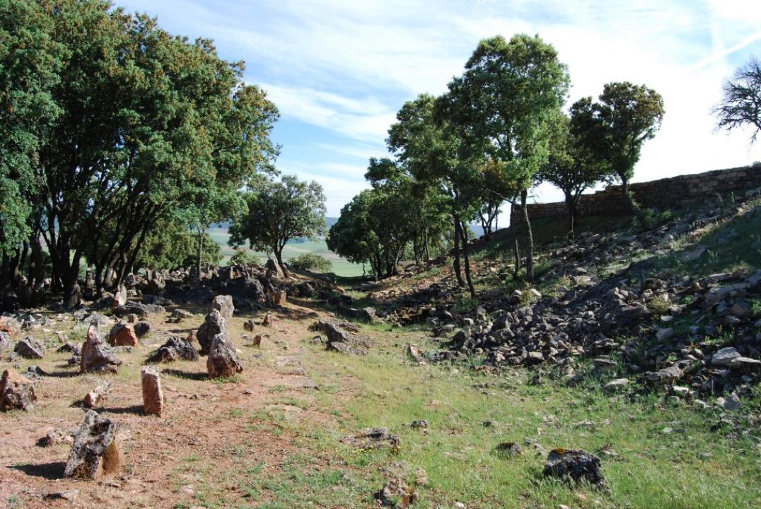
The fort is concentrating its defensive artificial elements on its western side, which is the most accessible, since the rest of its perimeter is well defended by natural cliffs. These elements are defensive wall, the moat and a kneeling stone barrier.
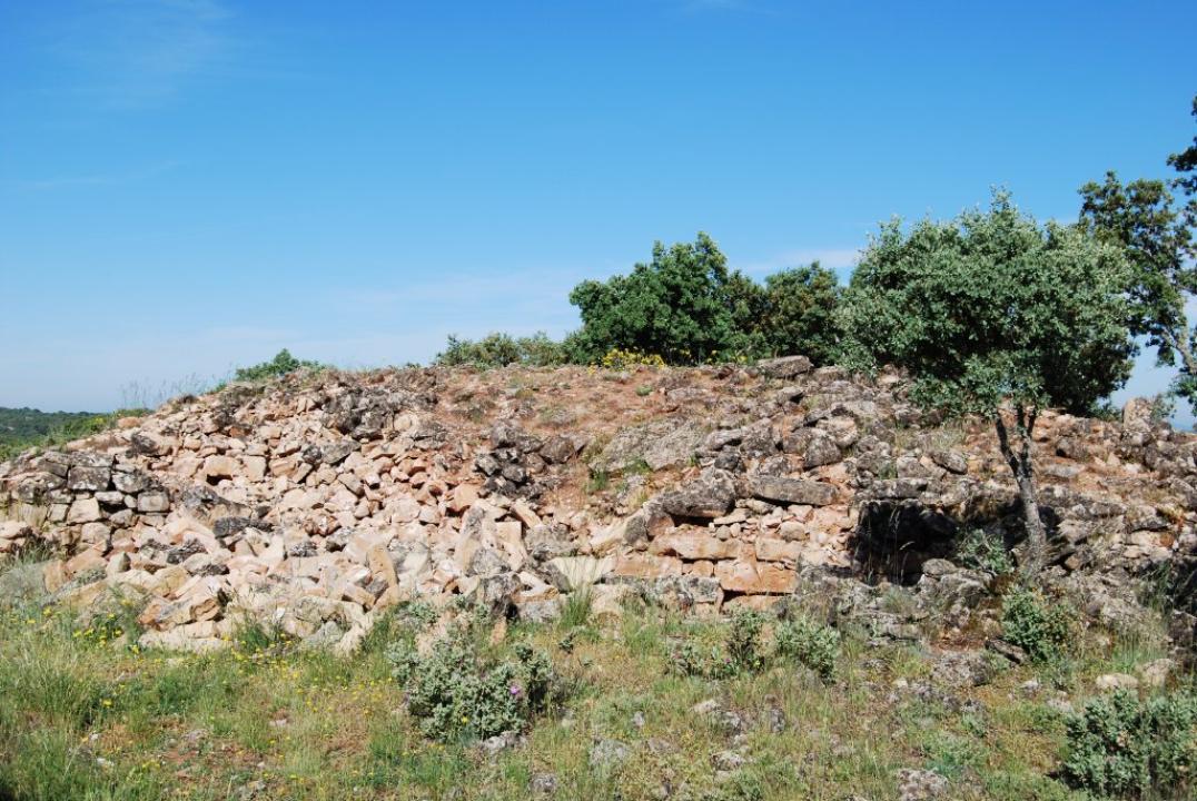
The excavation work performed in recent years it can now contemplate a part of the defensive system clean and recovered, and its contrast with a party without cleaning and digging, which is very educational.
The wall:
The wall seems to be placed on high ground, which seems artificial, which together with the small pit front contributes to enhance its size.
This wall, which closes the west side, is about 90m and is drawn in a north-south and has an average thickness of 2m. It consists of a double row, inside and out, worked better pleated limestone, especially on the outside, being filled, the intermediate zone, earth and stones of different sizes.
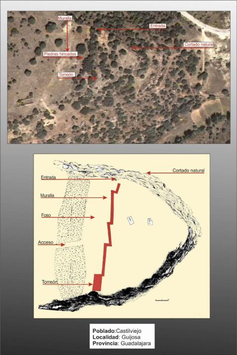
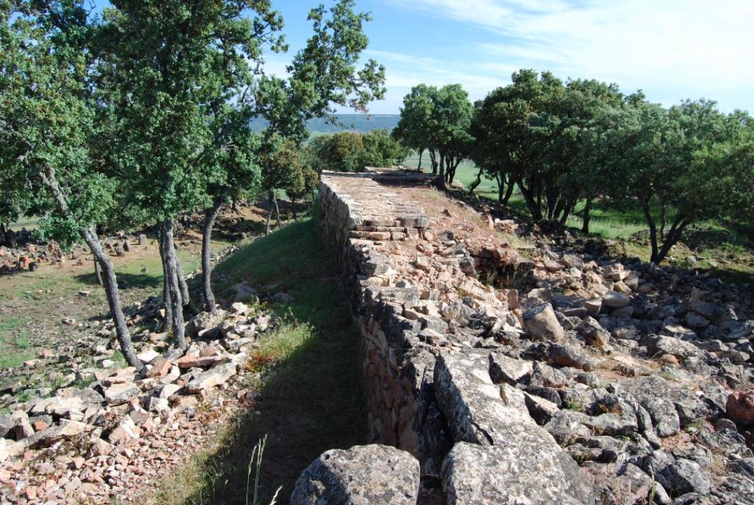
Presents a layered structure or zigzag, at the southern end topped by a tower, featuring five distinct sections:
The first north of the reservoir is nearly 7 m to the first side, the door shall be opened to access, without any special protection on the natural cut.
The next stage is larger, measuring 25m and reaches the second elbow.
"The third section has a length of 19m, reaching the third elbow.
"A fourth section, identical to the second, also has 25m and ends in a tower.
"The wall ends in the rocky escarpment of the south, in a tower (would be the fifth tranche), which is made simply by thickening of the wall in an elbow-shaped and rectangular (13 by 6m). It was built in successive rows staggered and would have the mission, while preventing access by the south side of the control Serviden natural valley that opens onto that side, where on the expiry step or natural way.
-The Pit:
In front of the wall there is a small pit, which serve as part of defensive structure, was removed in their execution of the stone to build the wall.
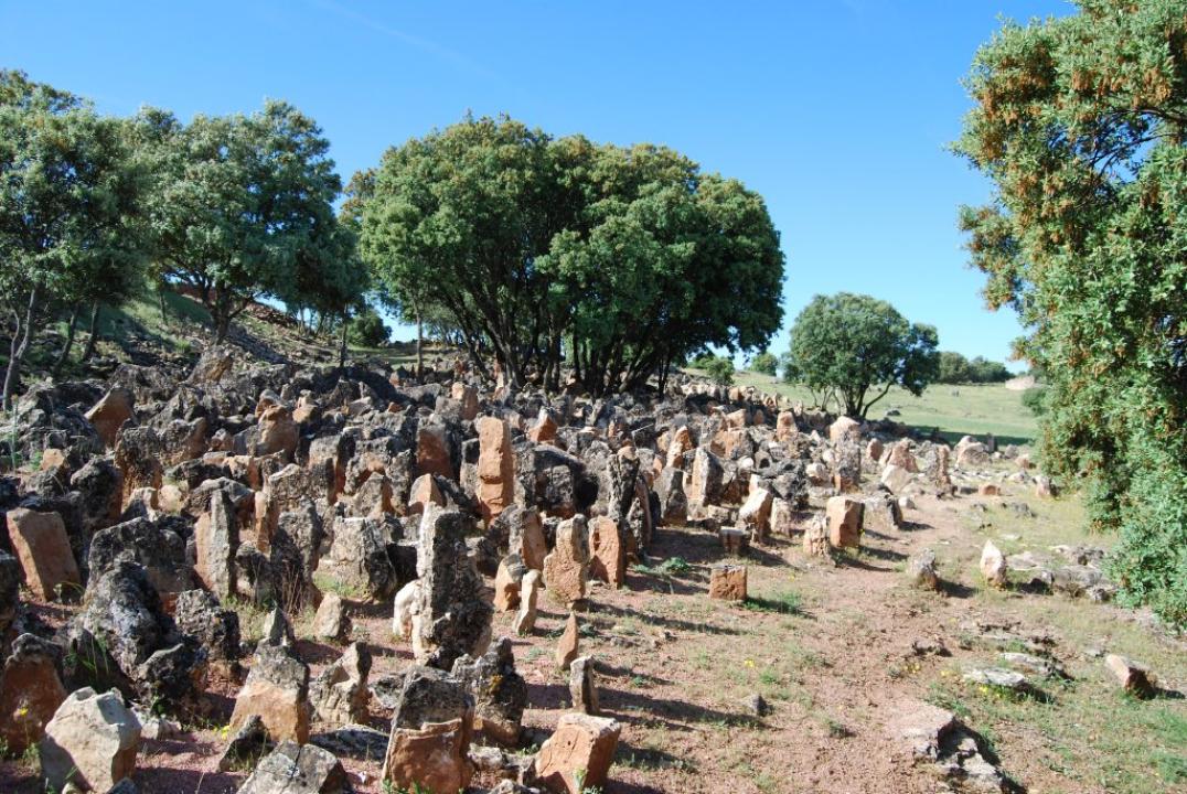
Kneeling stone-Barrera:
In front of the pit, you can see a stone barrier bowing to destabilize the attackers, divided into two groups on a regular basis (the north side is 56m long and 18m wide and about 40m south by 24m long width), topping the cut edge of the cut, which prevents access to the town, except for an aisle width of about 4m, which opens up between the two groups of stone.
Itinerary
Accessing the path of the east side of the hill to reach the top you enter the interior of the town, just the opposite side of the walled area. Thus the various point to visit are:
- Interior village
- Facing and interior of the wall collapse
- Gate entrance and exit between the wall and the northern escarpment
- Exterior of the wall: whole defensive system (rock piles, pit and wall), is available with an explanatory panel.
Contacts and schedules
- This site is free access.
- Has an information sign that explains the system's defensive fort and medieval elements that will overlap.
Bibliography
- Bethlehem, M,, Balbin, R., Fernandez-Miranda, M. (1978): Castilviejo of Guijosa, Wad-al-Hayara 5.